A rapidly-intensifying winter storm system known as a “bomb cyclone” targeted the Northeast on Thursday with snow, ice, bone-chilling winds and a central air pressure similar to that of the devastating Superstorm Sandy.
The wicked winter weather canceled thousands of flights and left schools shuttered across the region — and is still set to usher in “life-threatening” temperatures this weekend.
“This could be one of the strongest offshore storms we’ve ever experienced with a central pressure in the 950s,” Fox News Senior Meteorologist Janice Dean said.
Mesovortices near the center of the deepening east coast cyclone, as seen by @NOAA's #GOES16 1-minute visible imagery. #blizzard pic.twitter.com/p4p7bMIWwm
— NASA SPoRT (@NASA_SPoRT) January 4, 2018
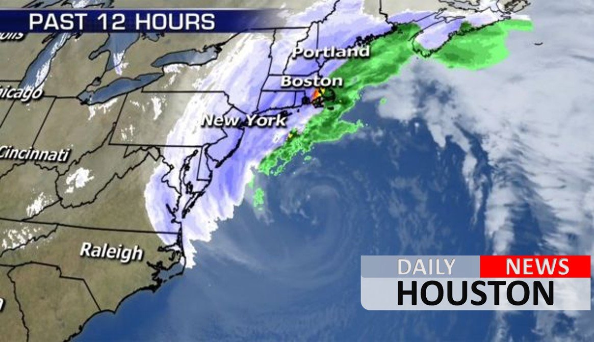
The National Weather Service issued blizzard warnings for parts of Delaware, Virginia, Maryland, coastal New Jersey, Long Island, N.Y., and coastal eastern New England. Most of those areas could see at least a foot of snow, while nearly 2 feet of snow was projected in locales further north.
The winter storm off the East coast has deepened ~24 millibars in a mere 7 hours. It is very rare for a storm to intensify so fast (usually 24 millibars in 24 hours is the standard for a rapidly intensifying storm). For all our friends out east…stay safe! pic.twitter.com/hgT7jmcA20
— NWS Marquette (@NWSMarquette) January 4, 2018
“Snowfall will increase northward into portions of the mid-Atlantic and New England through Thursday. Blizzard conditions are possible close to the coast in portions of the mid-Atlantic and Northeast,” the NWS said in its advisory. “Confidence in heavy snowfall has increased for parts of the Northeast as the surface low is expected to track closer to the coast and intensify rapidly.”
Some computer models have shown the storm with a minimum central air pressure below 950 millibars when it reaches its peak, which would be similar in strength to that of Superstorm Sandy, which had a minimum pressure of 945 millibars when it slammed into New Jersey in 2012, according to the National Oceanic and Atmospheric Administration.
This storm will stay completely out at sea, but bring winds “in excess of hurricane-force” along the coast, according to Dean, with “damaging” wind gusts of over 70 mph possible in coastal eastern Massachusetts, including Martha’s Vineyard and Nantucket Island by Thursday afternoon.
Ryan Maue, a meteorologist at the private firm Weather.US., said the storm is “one of fastest intensifying non-tropical storms in historical analysis.”
The storm moved out of the Southeast after bringing rare cold and snow to the region. Floridians in Tallahassee saw snow for the first time in nearly 30 years, while Charleston, S.C., saw at least 5 inches of snow and ice. Savannah, Ga., also received about 1.2 inches of snow.


